UOT 94(479.24)
https://doi.org/10.30546/3006-0346.2024.6.84.056
Хабил Надир оглу Исмайылов
Гянджинский Государственный Университет
E-mail: [email protected]
Резюме
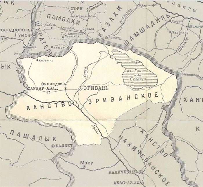
Природно-географическая территория, на которой расположена Иреванская губерния, в плане рельефа охватывает южную часть Малого Кавказа и ряд плато и высоких равнин с севера на юг к горе Агры. Возвышенности области располагались на севере провинции. Иреванская губерния была окружена с запада Карсской областью, с юга-Эрзурумской областью, северная часть-Гюмрийским плато. Восточная часть плато между горами Безобдал и Пембек граничила с западными границами верхним течением реки Борчалы. Границу Иреванской губернии с Елизаветпольской губернией составлял Зангезурский горный хребет.
Ключевые слова: Иреван, Малый Кавказ, губерния, гора, плато, река, граница.
Habil İsmayılov
Ganja State University
E-mail: h-ismayil@mail
Summary
The natural-geographical territory on which the Irevan province is located covers the southern part of the Lesser Caucasus and a number of plateaus and high plains from north to south to Mount Agra. The highlands of the region were located in the north of the province. The Irevan province was surrounded from the west by the Kars region, from the south by the Erzurum region, and the northern part by the Gyumri plateau. The eastern part of the plateau between the Bezoblal and Pembek mountains bordered the western borders by the upper reaches of the Borchaly River. The border of the Irevan province with the Yelizavetpol province was the Zangezur mountain range.
Key words: İrevan, Less Caucasus, province, mountain, plateau, river, border.


